Bidspirit auction | Harrison & Sons Map of
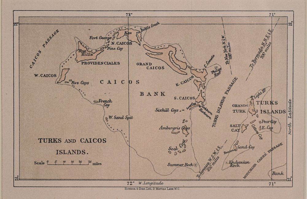
Harrison & Sons Map of Turks and Caicos, 19th Century - Harrison & Sons (British, 19th Century). Lithograph map, Turks and Caicos Islands, circa 1860. This cartographic print provides a detailed view of the archipelago, illustrating the Caicos Bank, the Turks Islands Passage, and individual islands including Salt Cay and Providenciales. Nautical information is included such as distances to New York, Bermuda, and Jamaica, alongside a printed bar scale. The map features fine line work and typography identifying geographic features such as Philips Reef, French Cay, and Ambergris Cays, as well as notations for the Mouchoir Carre Passage and various shoals. The work is presented in a gilded wood frame with a beveled cream mat. Marked at the bottom center Harrison & Sons Lith. St. Martins Lane W.C. A small label on the verso is inscribed c. 1860. Sight: 5 3/8 x 7 7/8 in. Frame: 9 7/8 x 12 3/8 in. From the personal collection of Peter Benchley (American, 1940–2006), acclaimed author of Jaws, accomplished diver, and prominent advocate for ocean and shark conservation.