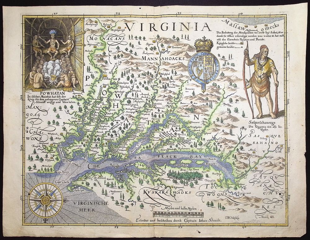
Bidspirit auction | Merian - Map of Virginia
Merian - Map of Virginia after Captain John Smith [Virginia - Erforshet und Beschriben durch Capitain Iohan Schmidt] - This map is Matthaeus Merian's Virginia - Erforshet und Beschriben durch Capitain Iohan Schmidt or Virginia - Explored and Described by Captain John Smith . It was published by Merian in Frankfurt in 1628. This map was first published in the thirteenth part of Theodore de Bry's Grands Voyages in 1590. This map is a derivative of three maps made by John Smith. The map is a beautiful, early representation of Virginia inspired by the important early mapping by John Smith. Smith's map was the earliest map of the first permanent English colony in America. It is decorated with the Royal Arms of Britain (colonial rulers of Virginia), standing Native American Indian, and a vignette of ”King Powhatan” (Pocahantas's father). Matthaeus Merian (1593-1650) was part of an exceptional artistic family. He was an artist and engraver himself that was born in Switzerland, and received training in engraving in Zurich, Nancy, Paris, and Strasbourg. He settled in Frankfurt where he worked for Johann Theodor de Bry, another accomplished publisher, and married his daughter, Maria Magdelena de Bry. He was the father of Matthaeus the Younger and the celebrated naturalist and artist, Maria Sibylla Merian. He took over De Bry's published house upon his death in 1623, and became particularly noted for his town views due to their artistry and accuracy. Paper Size: ~ 16” by 12 1/4” (Fold Out) Paper Type or Special Features: Engraving with Professional Hand-coloring