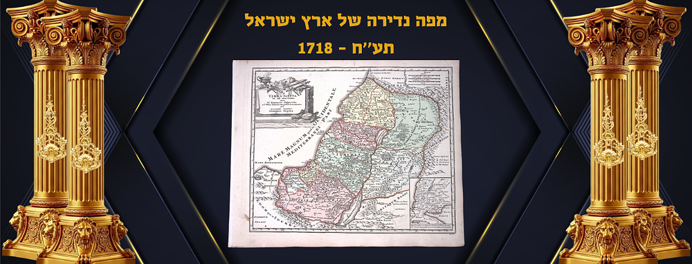
Bidspirit auction | Map of Holyland 1718
Map of Holyland 1718 - Map of Holyland This orig inally hand-colored engravina is from Johann David Kohler's: Bequemer Schul- und Reisenatlas aller zu Erlernuna der alten, mittlern und neuen Geographie dienlichen Universal- und Particular-Charten or School and Travel Atlas.. The work was published in Nuremberg by J. E. Adelbulner for C. Weigel in 1719. This is considered the enlarged edition of Christoph Weigel's atlas that was first printed in 1718, this published likely for Weigel's widow and heirs. ”In 1718, the first atlas was published, with a dated title page, which was then published by Johann David Kohler after Faber's death. The title page of the Comfortable School and Travel Atlas, as the new sitio fth a work from now on is particularlv emphasizes 'the new special way' in which the maps are now illuminated, a fact that Hauber had also pointed out regarding this coloring, Köhler had preceded the atlas with a typographically printed plate on which he, after a short introduction to geography, the ill umination of the first five universal maps, which he systematically developed - these are the world map and the maps of Europe, Asia, Africa and America - was explained here in addition to the marking of the political boundaries Territories and the coloring of their surfaces with the same but more diluted color, information about the religion of the population of the respective area was provided through colored lots.''(Bauer Sp. 954)