Bidspirit auction | ORTELIUS, ABRAHAM.
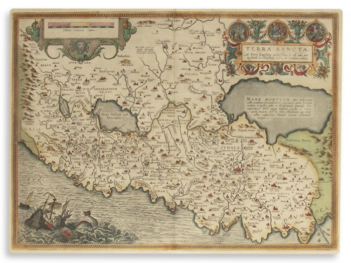
ORTELIUS, ABRAHAM. - “Terra Sancta. A Petro Laicstain perlustrata, et ab eius ore e t schedis a Christiano Schrot in tabulam redacta.” Hand-colored copperplate map, double-page. 15 x 20.5 inches (38 x 52 cm) to mat. Finely framed. Antwerp, first edition 1584 (or later): Based on Christian Sgrothen (Christian Schrot)’s 9-sheet map of Palestine (1570) and modeled after sources by the Dutch astronomer Petrus Laiksteen collected during his travels to the Holy Land. The map marks the shore line from Beirut to Gaza with fanciful details such as fictitious bays and peninsulas. Medallions in the cartouche at upper right illustrate Biblical scenes from the life of Jesus, with a dramatic vignette of Jonah thrown to a large whale at lower left.