Bidspirit auction | W. & A. K. Johnston
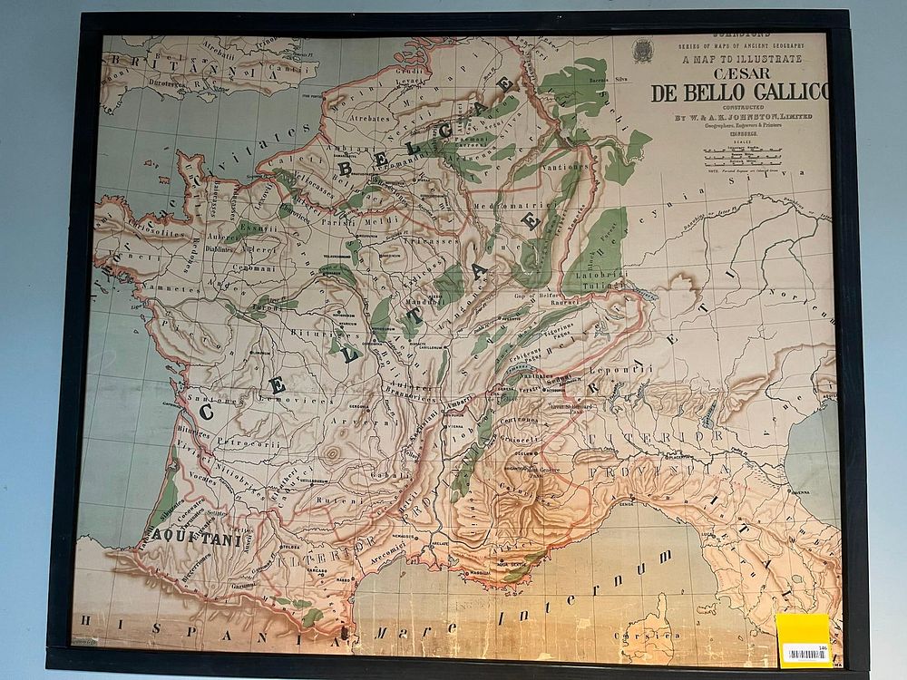
W. & A. K. Johnston Caesar Gallico Map - This color lithograph map, titled A Map to Illustrate Caesar De Bello Gallico, depicts the tribal territories and geography of ancient Gaul as described in Julius Caesar's Commentaries on the Gallic War. The map is part of the Series of Maps of Ancient Geography and was constructed by the Edinburgh-based firm W. & A. K. Johnston, Limited. The print features detailed demarcations of regions inhabited by the Belgae, Celtae, and Aquitani, with ancient Latin place names and topographical features like mountain ranges and river systems. A note in the upper right corner states that forested regions are colored green. The map includes three scales for Itinerary Stadia, Roman Miles, and British Miles. The upper right corner bears printed text reading SERIES OF MAPS OF ANCIENT GEOGRAPHY / A MAP TO ILLUSTRATE / CAESAR / DE BELLO GALLICO / CONSTRUCTED / BY W. & A. K. JOHNSTON, LIMITED / Geographers, Engravers & Printers / EDINBURGH. The work is presented in a simple black wooden frame. A yellow adhesive auction label with the printed number 146 is attached to the glass in the lower right corner. A small, partially illegible label is visible in the lower left corner of the map sheet.