Bidspirit auction | Set 4 A.J. Nystrom &
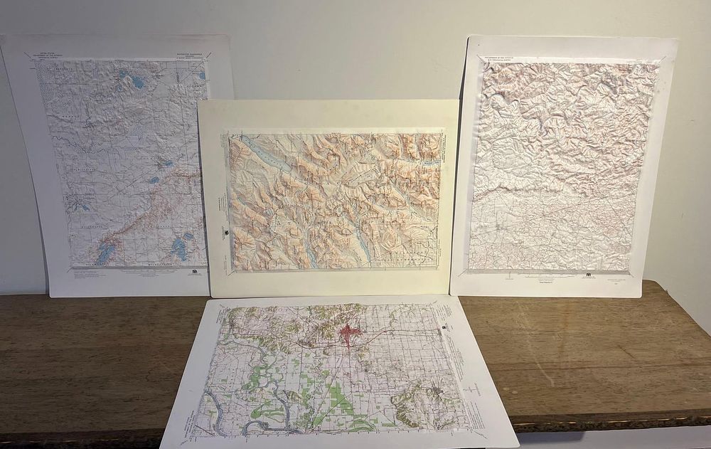
Set 4 A.J. Nystrom & Co. 3D Relief Maps - A set of four three-dimensional raised-relief topographical maps produced from vacuum-formed printed plastic. The maps were published by A. J. Nystrom and Co. of Chicago, Illinois, using topographical data provided by the United States Geological Survey. The collection includes individual maps depicting Glacier National Park (Chief Mountain Quadrangle), Mammoth Cave National Park (Kentucky), and Whitewater, Wisconsin, along with a fourth map showing a river valley and an urban center highlighted in red. The Glacier National Park map illustrates the rugged terrain of the Rocky Mountains, including Lake McDonald and the Continental Divide, based on 1955 aerial photographs and field-checked in 1960. The Mammoth Cave map displays the karst topography and the meandering Green River, based on a 1922 survey with a vertical exaggeration of 4:1. The Whitewater map covers the Kettle Moraine region, including the communities of Jefferson, Sullivan, and Palmyra. Printed details on the margins include a publisher logo consisting of a stylized lowercase n within a circular globe grid. Text on the bottom margins reads A. J. NYSTROM & CO. 3333 Elston Avenue, Chicago, Illinois 60618. Institutional credits are printed as UNITED STATES DEPARTMENT OF THE INTERIOR GEOLOGICAL SURVEY. Specific locations are identified by the printed titles CHIEF MOUNTAIN MONT., MAMMOTH CAVE, KY 1922, and WHITEWATER WISCONSIN.